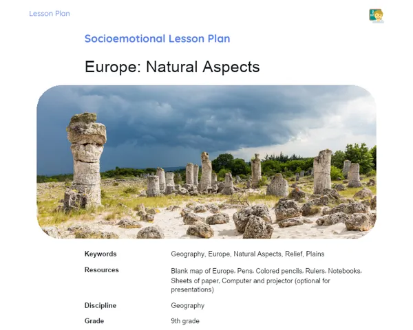
Lesson Plan | Active Methodology | Cartography: Time and Space: Review
| Keywords | Cartography, Map Reading, Geographic Elements, Spatial Understanding, Practical Challenges, Teamwork, Urban Planning, Historical Maps, Knowledge Application, Critical Thinking, Sustainability, Geographic Education |
| Necessary Materials | Printed maps, Scales, Compasses, Blank paper for maps, Information about natural resources and landforms, Copies of local historical maps, Markers, Ruler, Note-taking materials |
Premises: This Active Lesson Plan assumes: a 100-minute class duration, prior student study both with the Book and the beginning of Project development, and that only one activity (among the three suggested) will be chosen to be carried out during the class, as each activity is designed to take up a large part of the available time.
Objective
Duration: (5 - 10 minutes)
Setting clear objectives is crucial for giving students a focused foundation of what they need to learn and apply during class. By defining structured goals, teachers can effectively steer their lessons and practical activities to enhance students' learning experience. In this lesson, the objectives focus on understanding geographic factors and reading maps, which are vital for fostering a critical and contextual understanding of the world around us.
Objective Utama:
1. Understand the geographic elements that shape the creation of maps, which are essential to grasping the geographic landscape.
2. Develop the competence to read and interpret maps as tools for locating and understanding changes over time in a specific area.
Objective Tambahan:
- Encourage critical thinking by exploring how geographic changes can be represented and anticipated through maps.
Introduction
Duration: (15 - 20 minutes)
The introduction aims to engage students with the lesson theme, encouraging them to think about how the knowledge gained at home can be applied practically. The problems presented foster critical thinking and the application of cartography concepts to real or hypothetical situations, laying a foundation for active and meaningful learning. Contextualization helps connect the content to the real world, showcasing how cartography serves as a dynamic and essential tool in various historical and contemporary contexts.
Problem-Based Situation
1. Imagine your city is planning a major urban expansion. What geographic elements would be key to mapping this expansion? How could historical maps help in understanding how the area has evolved and guide decisions in the new planning?
2. What if an archaeologist finds ancient ruins in a secluded part of the Amazon? How could they use cartography to pinpoint the exact location of these findings and eventually incorporate this data into a map of the archaeological site?
Contextualization
Cartography is not merely about spatial representation but also a science that has developed to meet practical and theoretical needs across various fields. For instance, during the Middle Ages, maps were instrumental in navigation and territorial expansion. Nowadays, cartography is essential for urban planning, managing natural resources, and even in disaster preparedness. Additionally, stories like Martin Behaim's creation of the first globe in 1492 can captivate students, highlighting the cultural and scientific significance of maps.
Development
Duration: (75 - 90 minutes)
The Development phase enables students to actively and interactively utilize concepts they’ve studied at home, employing maps and geographic coordinates. Through playful and engaging tasks, they will reinforce their understanding of cartography and map reading while honing teamwork, critical thinking, and problem-solving abilities. The activities are either fictional or adapted from real-world scenarios that simulate situations where cartographic understanding is indispensable, thereby ensuring active and engaging learning.
Activity Suggestions
It is recommended that only one of the suggested activities be carried out
Activity 1 - Cartographic Expedition: Discovering the Lost Treasure
> Duration: (60 - 70 minutes)
- Objective: Utilize knowledge of cartography and physical geography to tackle a practical challenge, fostering teamwork and navigation skills.
- Description: Students will form groups of up to five and each group will receive a 'treasure map' featuring geographical coordinates and historical details of a fictional location. Their task is to use their cartographic knowledge to decode the map, plot a route, and find the 'treasure' (which could be a box of sweets or small prizes).
- Instructions:
-
Distribute the maps and materials to each group.
-
Instruct each group to pinpoint key locations on the map along with their coordinates.
-
Guide students in using scales and compasses to ascertain the direction and distance between points.
-
Students should document any challenges or questions they encounter during the expedition.
-
Once the treasure is uncovered, each group will present their journey and share the strategies they employed to reach it, discussing any obstacles faced.
Activity 2 - City Builders: The Urban Planning Challenge
> Duration: (60 - 70 minutes)
- Objective: Enhance planning and geographic analysis abilities while applying concepts of cartography and sustainability.
- Description: In this group activity, students will receive a 'blank' plot of land and will be tasked with designing a fictional city using maps and information about natural resources, landforms, and risk zones. The aim is to create a sustainable city that considers accessibility and environmental conservation.
- Instructions:
-
Present each group with a blank map of the land along with information on available resources and local restrictions.
-
Students must use scales to draft the city's layout, accounting for residential, commercial, and industrial areas.
-
Encourage the use of legends to indicate risk zones, environmentally sensitive areas, and public facilities.
-
Each group will showcase their project, justifying their urban planning choices based on the provided data and cartographic principles utilized.
Activity 3 - Mystery Hunters: Unraveling the Past with Historical Maps
> Duration: (60 - 70 minutes)
- Objective: Leverage historical maps to comprehend and articulate geographical and social changes, fostering historical and geographic awareness.
- Description: In this group task, students will receive copies of historical maps of the area where their school is located. The challenge is to identify important landmarks such as schools, hospitals, or geographical changes over time, using the old maps and contrasting them with the current layout.
- Instructions:
-
Distribute the historical and current maps to each group.
-
Request that students locate significant landmarks and highlight them on both sets of maps.
-
Facilitate a discussion on the geographical changes observed and what implications these might have regarding the city's development.
-
Each group will prepare a brief presentation of their findings, underscoring the role of cartography in preserving history and analyzing geographical shifts.
Feedback
Duration: (10 - 15 minutes)
This feedback stage is vital for solidifying learning, allowing students to articulate their acquired knowledge within a broader context and discuss the practical applications of cartography concepts. Group discussions promote the exchange of perspectives and ideas, helping students recognize the relevance of their learning beyond the activities. The guiding questions aim to foster reflection and ensure that all critical aspects have been understood.
Group Discussion
Initiate the group discussion with a short introduction, expressing gratitude for everyone’s participation and stressing the importance of sharing insights and experiences. Encourage each group to summarize their discussions, highlighting the primary challenges they faced and the strategies they used to overcome them. Urge students to relate the activities to real-world situations or to concepts previously studied.
Key Questions
1. What were the main difficulties in interpreting and applying the maps during the activities?
2. How did understanding geographic elements assist in navigating the challenges faced during the tasks?
3. In what ways can the skills honed today be applied in real-life scenarios or future studies?
Conclusion
Duration: (5 - 10 minutes)
The Conclusion stage serves to ensure that students have consolidated the knowledge acquired during the lesson, linking theoretical and practical content with real-world applications. This moment is also an opportunity to endorse the importance of studying cartography, motivating students to appreciate and apply learned concepts across different aspects of their lives and future academic or career paths.
Summary
In concluding the lesson, the teacher should summarize and reiterate the main concepts covered, underscoring the understanding of geographical elements and map reading as tools for interpreting space and time. It's important for students to grasp how these concepts are practically applicable and how they were utilized throughout the lesson activities.
Theory Connection
Throughout the lesson, a bridge was established between theory and practice via interactive activities simulating real scenarios, such as urban planning and the analysis of historical maps. This allowed students to witness the direct application of theoretical concepts studied at home, and understand how this knowledge can be employed in practical and professional contexts.
Closing
Finally, the teacher should highlight the significance of cartography in everyday life, noting that map reading and comprehension are fundamental skills in various professions, including urban planning, archaeology, and environmental management. Additionally, reinforce the cultural and scientific value of maps, demonstrating how they aid in preserving history and planning for the future.