Objectives
1. 🎨 Identify and distinguish between drawings, mind maps, and models as different forms of geographical representation.
2. 🎨 Develop hands-on skills to create simple drawings and mind maps, applying them to represent various spaces and places.
3. 🎨 Spark creativity and critical thinking by delving into and capturing geographical and urban elements.
Contextualization
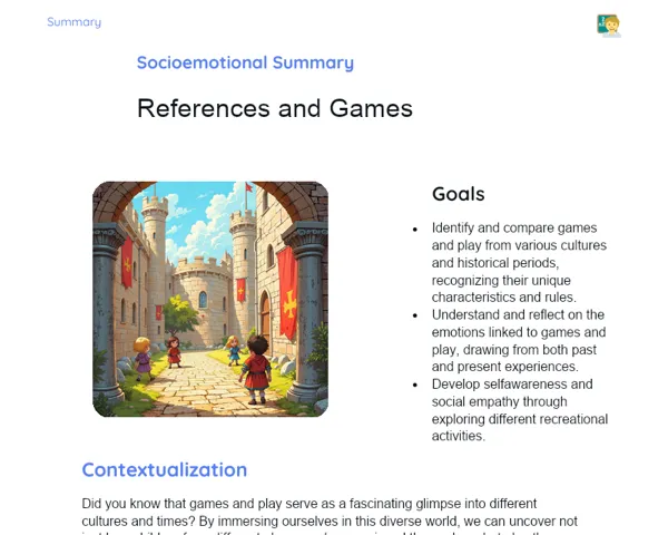
Did you know that people have been drawing maps for over 8,000 years? The earliest maps were crafted on clay and stone to guide adventurers on their journeys. Today, maps remain an indispensable tool, morphing into modern techniques like mind maps, which are super handy for creatively organising our thoughts and information. These methods aren’t just for geographers; anyone can use them to enhance planning, communication, and understanding of our world. Get ready to unleash your creativity and become the cartographer of your own 21st-century adventure!
Important Topics
Mind Maps
Mind maps are visual aids that help organise information logically and creatively, using keywords and imagery. They're brilliant for simplifying complicated concepts and illustrating relationships, making comprehension and retention easier. In geography, mind maps can explore and detail the structure of a place, considering both its physical and human aspects.
-
Help organise and visualise complex geographic ideas.
-
Incorporate visual and text elements, making content more digestible.
-
Support memory retention and comprehension, serving as valuable study aids.
Geographic Drawings
Geographic drawings provide artistic or technical depictions of geographical features like mountains, rivers, and towns. They're crucial for grasping a place’s topography and play a key role in cartography and urban planning. Developing skills in geographic drawing allows students to express and appreciate the physical characteristics of locations.
-
Enable a detailed and realistic portrayal of physical features.
-
Are foundational for cartography and spatial planning.
-
Cultivate observation and representation skills beneficial in geography and other subjects.
Models
Models are three-dimensional representations of geographic areas or constructed environments. They help visualize and plan everything from little gardens to large city projects. In geography education, models assist students in understanding the connections within geographic spaces and the necessity of planning in human development.
-
Provide a concrete and tactile way to visualise geographic or urban areas.
-
Serve as excellent teaching tools that demystify complex geographic ideas.
-
Foster planning and execution skills while encouraging creativity.
Key Terms
-
Mind Map: A visual tool that organizes information in a hierarchical and radial format, ideal for depicting concepts and relationships.
-
Geographic Drawing: An artistic or technical illustration of geographic elements that helps comprehend the topography and physical characteristics of locations.
-
Model: A three-dimensional representation of a geographical or urban area, essential for planning and visualising projects.
For Reflection
-
How might mind maps assist you in grasping a new geographical concept?
-
In what ways could geographic drawings enhance your appreciation of your community or city?
-
Why is creating models vital for studying human impacts on geographical environments?
Important Conclusions
-
We delved into mind maps, geographic drawings, and models, which are essential for understanding and representing our environment.
-
We talked about how each of these representation forms can be integrated into everyday life, from studying schoolwork to planning community events and urban initiatives.
-
We recognised the significance of each technique and how they can work in tandem to enrich our geographic insights and creativity.
To Exercise Knowledge
- Create a mind map that illustrates your daily routine, including school, sports, and leisure activities. 2. Sketch a small section of your neighbourhood, marking parks, streets, and notable buildings. 3. Use recyclable materials to craft a simple model of a nearby park or public square.
Challenge
Urban Explorer Challenge: With the help of an adult, venture into a new part of your city and develop a mind map or drawing that captures your discoveries. Include interesting details and spots you'd love to revisit!
Study Tips
-
Practice your drawing skills regularly to boost your geographical representation abilities. Start by sketching simple maps of places you know well.
-
Utilise mind mapping apps to organise your thoughts for school and personal projects, making information clearer and easier to remember.
-
Watch documentaries or educational videos about cartography and urban planning to see how professionals use these techniques in the real world.