Summary Tradisional | Geomorphology: Endogenous and Exogenous Agents
Contextualization
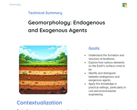
Geomorphology is the study of landforms and the processes that shape them, both from within the earth and from external forces. This subject helps us understand how mountains, valleys, plains, and other features of the Earth's surface are formed and modified over time. Grasping these processes is crucial for forecasting landscape changes and planning our activities in a sustainable manner, whether in agriculture, urban development, or preventing natural disasters.
In this context, internal (endogenous) and external (exogenous) processes are the key forces behind the dynamics of our earth's surface. Endogenous processes, such as tectonic movements, volcanic activity, and earthquakes, take place within the Earth and lead to the creation of new landforms by moving tectonic plates and causing volcanic eruptions. In contrast, exogenous processes, including weathering, erosion, and sedimentation, act on the surface itself, gradually wearing away and reshaping existing features. The continuous interaction between these forces results in a constantly evolving landscape, reflecting the intricate and dynamic nature of our planet.
To Remember!
Internal (Endogenous) Processes
Internal processes are those happening within the Earth that lead to the formation and change of landforms. These include tectonic movements, volcanic eruptions, and earthquakes. Tectonism involves the movement of the Earth’s plates, which may diverge, converge, or slide past each other, leading to the creation of mountains, faults, and folds. A classic example can be seen in the formation of the Himalayan range when two plates push against each other.
Volcanism refers to the process when magma reaches the Earth’s surface, forming volcanoes, volcanic islands, and lava flows. When magma exits as lava and cools down, it solidifies to form fresh rock. This activity is common near subduction zones, where one tectonic plate goes beneath another, or at mid-ocean ridges, where the plates drift apart and magma fills the gaps.
Earthquakes are the result of sudden movements of tectonic plates, which release stored energy in the form of seismic waves. These tremors can vary in intensity and bring significant changes to the landscape, including the formation of new faults, uplift or sinking of land, and may trigger landslides or even tsunamis that affect both nature and local communities.
-
Movement of tectonic plates leads to the formation of mountains, faults, and folds.
-
Volcanism brings magma to the surface, resulting in volcanoes and the creation of new islands.
-
Earthquakes, caused by sudden plate movements, are major agents of landscape change.
External (Exogenous) Processes
External processes are the forces acting on the Earth’s surface that wear down and transform the landscape. These include weathering, erosion, and sedimentation. Weathering involves the breakdown of rocks due to physical, chemical, and biological factors. For instance, physical weathering occurs due to temperature changes and the action of ice, while chemical weathering changes the mineral composition of rocks through chemical reactions. Biological weathering, on the other hand, is brought about by organisms like plant roots and microbes.
Erosion is the process of removing material from the Earth’s surface by the action of wind, water, and ice. River erosion, for example, creates valleys and canyons, while wind erosion forms dunes in desert regions. Similarly, glaciers also shape the land, especially in higher altitudes or latitudes, resulting in features such as U-shaped valleys and fjords.
Sedimentation follows as eroded materials are deposited in new locations, leading to the formation of plains, deltas, or alluvial fans. Such deposited sediments, especially near river deltas, also create fertile soils which are vital for agriculture. This continuous deposition eventually compacts and hardens to form new sedimentary rocks.
-
Weathering breaks down rocks through physical, chemical, and biological actions.
-
Erosion gradually wears out the landscape through the work of wind, water, and ice.
-
Sedimentation deposits eroded materials, creating new features like plains and deltas.
Interplay Between Internal and External Processes
The continuous interaction between internal and external processes brings about the ongoing reshaping of our landforms. Activities within the Earth, like tectonic movements, may form mountains and volcanoes, which are then eroded by external processes such as weathering and erosion. For instance, mountains formed by tectonism are slowly worn down by weathering and erosion, creating soils and sediments that are later transported and redeposited elsewhere.
This never-ending cycle is key to understanding the evolution of landscapes over geological time. Sediments deposited in river deltas or plains can later be uplifted by tectonic forces, leading to the creation of new features, which in turn are subject to further erosion. Such interplay is fundamental not only in natural landscapes but also for practical applications in planning and disaster management.
Knowing how these processes interact is essential for natural disaster management and urban planning. Recognising regions prone to erosion or seismic activity can help in building safer infrastructure and preventing hazards like landslides. Moreover, sustainable agricultural practices rely on understanding these natural processes, particularly in soil management.
-
Mountains formed by tectonic processes are continuously eroded by natural forces.
-
Eroded sediments get redeposited elsewhere, forming new landforms.
-
Understanding the interaction between these processes aids in disaster management and urban planning.
Practical Applications of Geomorphology
Geomorphology is not just an academic subject; it has very practical applications that benefit our day-to-day lives and sustainable development. One of its key applications is in the area of natural disaster prevention. By understanding the underlying geomorphological processes, we can predict events such as landslides, floods, and earthquakes and take steps to reduce the risks and damages they cause.
In urban planning, the insights provided by geomorphology are critical when selecting safe areas for construction. A detailed insight into the landscape and the history of erosion can guide the planning of roads, bridges, and buildings, thereby minimising environmental and social disruptions.
For agriculture, understanding weathering and erosion is essential for soil conservation. Techniques such as crop rotation and the use of cover crops are based on this knowledge, ensuring that the soil remains fertile and productive. Managing water resources in areas prone to erosion also depends on these insights, helping to maintain water quality and availability for everyone.
-
Predicting natural disasters by understanding geomorphological processes.
-
Safe urban planning through careful analysis of the landscape and erosion history.
-
Improved soil conservation and agricultural productivity via insights into weathering and erosion.
Key Terms
-
Geomorphology: The study of landforms and the processes that shape them.
-
Tectonism: Movement of tectonic plates leading to the formation of mountains, faults, and folds.
-
Volcanism: The process of magma being pushed to the surface, forming volcanoes.
-
Earthquakes: Seismic events caused by the sudden movement of tectonic plates.
-
Weathering: The breakdown of rocks through physical, chemical, and biological processes.
-
Erosion: The wearing away of the landscape by natural forces like wind, water, and ice.
-
Sedimentation: The deposition of eroded materials that eventually form new landforms like plains and deltas.
Important Conclusions
In summary, our lesson on geomorphology examined the internal and external processes that sculpt the Earth’s landscape. Internal processes such as tectonism, volcanism, and earthquakes build up new features, while external processes like weathering, erosion, and sedimentation gradually wear them down and remodel them. This ongoing interplay results in the ever-changing face of our planet.
Understanding these processes is vital for many practical reasons, including natural disaster prevention, urban planning, and soil conservation. By being aware of these natural forces, we can predict events better and take proactive steps to protect communities and ensure sustainable development. Moreover, managing our natural resources wisely depends on a thorough grasp of how the landscape evolves.
Thus, geomorphology not only deepens our knowledge of natural history but also equips us with the tools needed for improving quality of life and preserving our environment. I encourage you all to explore this fascinating topic further, as it beautifully bridges science, practical applications, and our everyday challenges.
Study Tips
-
Revisit the ideas of internal and external processes with examples from your local environment.
-
Watch documentaries or educational videos on geomorphology to see these processes in action.
-
Practise by interpreting maps and satellite images to identify different landforms and understand the underlying processes.