Objectives
1. Identify and describe the main types of landforms: mountains, plateaus, depressions, and plains, highlighting their unique physical and geographical features.
2. Apply your understanding of landforms in real-world scenarios, utilizing maps and satellite images to see how these formations impact nature and human activities.
3. Cultivate analytical skills to compare different landforms and their effects on the environment and society.
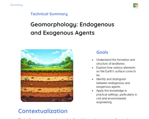
Contextualization
Did you know that Mount Everest, the tallest peak in the world, is still growing? It's true! Mountains are impressive structures that are constantly changing due to the shifting of the Earth's tectonic plates. This ongoing change illustrates how studying landforms is dynamic and relevant, not just for geologists but for everyone who interacts with the natural world. By understanding the traits of different landforms, we can better design our cities, manage resources wisely, and even forecast natural calamities.
Important Topics
Mountains
Mountains are natural elevations of the Earth formed primarily by tectonic plate movements that push the crust upward, a process known as orogeny. They are crucial for biodiversity as they provide varied and often unique habitats, influencing local and regional climates.
-
Geological formation: Mountains arise mainly from tectonic plate movements but may also result from volcanic activity.
-
Environmental impact: They alter climate patterns by changing wind flow and precipitation, leading to microclimates that affect the distribution of flora and fauna.
-
Cultural and economic importance: Many mountains are imbued with spiritual significance and also serve as hotspots for tourism and adventure sports like trekking and mountaineering.
Plateaus
Plateaus are elevated areas with flat or gently sloped surfaces, typically created through volcanic eruptions or erosion that exposes hard rock. They are vital for agriculture due to their fertile soil, making them rich in natural resources.
-
Formation: Plateaus can originate from volcanic activity or erosion where harder rock survives while softer layers are worn away.
-
Agriculture: Their nutrient-rich soils boost crops, particularly in areas where surrounding plains may lack fertility.
-
Biodiversity: Plateaus support unique ecosystems hosting various plants and animals adapted to specific altitudes.
Depressions
Depressions refer to lower areas of the Earth's surface, usually formed through land subsidence or erosion. They can create formations such as valleys or sedimentary basins, essential for lakes and rivers, thereby sustaining aquatic ecosystems and the water cycle.
-
Formation: Depressions form due to geological processes or significant erosion that removes surface material.
-
Hydrography: They play crucial roles in water collection, forming vital water bodies for both wildlife and human use.
-
Environmental impact: Understanding depressions is key for water management, urban planning, and environmental impact assessments.
Key Terms
-
Landform: Variations in the Earth's surface, including mountains, plateaus, and depressions.
-
Orogeny: The process by which mountains are formed through tectonic activity.
-
Erosion: The wearing away of rocks and soil by wind, water, or natural processes, significantly reshaping the landscape.
-
Sedimentary Basins: Geological depressions that collect sediments carried by various erosive forces.
For Reflection
-
How do mountains influence the climate of a particular region?
-
In what ways do plateaus enhance biodiversity and contribute to the economy?
-
Why are depressions important in the water cycle and sustaining aquatic ecosystems?
Important Conclusions
-
Today, we delved into the intriguing worlds of mountains, plateaus, depressions, and plains, each with their distinctive features and major impacts on our environment and society.
-
Gaining knowledge about these landforms enriches our geographical understanding and allows us to interact wisely and respectfully with our surroundings.
-
The insights we gathered today lay the groundwork for future geographical studies, city planning, and even our adventurous journeys around the world.
To Exercise Knowledge
Create a three-dimensional model of different landforms using eco-friendly materials. Write a brief essay on how the landforms in your area affect climate and agriculture. Design an infographic demonstrating the connection between landforms and the ecosystems they nurture.
Challenge
Draft a fictional expedition log detailing an exploration of an uncharted mountain, describing the geographical challenges faced and how you applied your knowledge of landforms to navigate through them.
Study Tips
-
Utilize interactive online maps to understand landforms across the globe and observe their effects on city and country layouts.
-
Watch documentaries that showcase geological formations to visualize the processes discussed in class on a grand scale.
-
Explore augmented reality apps that enable you to interact with and visualize various types of landforms and their characteristics.