Summary Tradisional | Cartography: Map Reading and Making
Contextualization
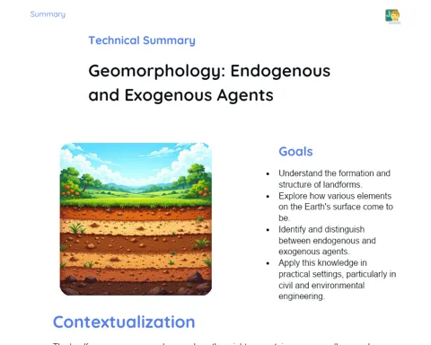
Cartography is the science behind creating and studying maps. Since ancient times, maps have been indispensable for humanity, aiding explorers in discovering new lands, helping armies devise strategic plans, and assisting everyday people in grasping the geography of their surroundings. In today’s world, maps are everywhere — in navigation apps on our phones, in school textbooks, and even in video games. This widespread presence underscores the continued significance of maps as vital tools for navigation and planning.
With the advent of technology, cartography has transformed dramatically. Modern resources like satellites and GPS systems allow for the production of highly accurate and detailed maps. These tools are utilized not just for navigation, but also for environmental studies, urban planning, and monitoring natural disasters, among many other functionalities. Therefore, grasping the basics of cartography and being able to interpret maps is a critical skill for navigating daily life and understanding the geographic landscape.
To Remember!
What is a Map
A map is a visual representation of a geographical area, made to depict features such as roads, rivers, hills, and borders in an easy-to-understand way. Maps serve multiple purposes, from aiding navigation to assisting in urban planning, and are fundamental across various fields, including Geography. They enable individuals to visualize complex geographic information more effectively, helping them understand their environmental surroundings better.
Cartography, the discipline focused on creating and studying maps, employs specific techniques to convert geographic data into visual forms. This includes decisions on which features to showcase, selecting suitable cartographic projections, and applying specific symbols to ensure the information is clear and accurate. Each type of map is tailored to serve distinct purposes, changing in detail and scope based on the user's needs.
Maps can be static, like those found in books and atlases, or dynamic, seen in navigation apps and Geographic Information Systems (GIS). The choice of map type relies heavily on the user’s requirements and context. In classrooms, maps are vital tools for conveying geographic concepts, enabling students to visualize and better comprehend spatial relationships and the characteristics of the area being studied.
-
Maps are visual representations of geographical regions.
-
Used for navigation, urban planning, and education.
-
Can be static (printed) or dynamic (digital).
Elements of a Map
Maps consist of various elements that help in understanding and interpreting the geographical information they convey. Important components include the title, legend, scale, compass rose, and geographic coordinates. Each plays a significant role in how maps are read and analyzed, allowing users to gather accurate and relevant information.
The title of a map indicates the theme or area it represents, giving a brief overview of what to expect. The legend elaborates on the symbols and colors used within the map, aiding comprehension of the information presented. The scale illustrates the relationship between distances shown on the map and actual distances on the ground, which is crucial for accurately interpreting geographic dimensions. The compass rose shows the cardinal directions (North, South, East, and West), helping with spatial orientation. Geographic coordinates, represented by lines of latitude and longitude, enable the precise location of any point on the Earth’s surface.
Grasping these elements is essential for accurately reading maps. A lack of awareness regarding them can lead to incorrect interpretations and oversight of vital information. Therefore, it’s important for students to learn to recognize and utilize each component while studying geography and applying maps in everyday contexts.
-
The title indicates the theme or area represented.
-
The legend explains the symbols and colors used.
-
The scale shows the relationship between distances on the map and the terrain.
-
The compass rose indicates the cardinal points.
-
Geographic coordinates allow for the location of specific points.
Types of Maps
There are several kinds of maps, each serving unique purposes and bearing specific characteristics. Common examples include political, physical, and thematic maps. Each type of map is crafted to address distinct needs, differing in detail and emphasis based on the user’s intent.
Political maps delineate boundaries between countries, states, and cities, highlighting political and administrative divisions. They are instrumental in comprehending the political landscape of a region and find extensive use in educational materials. Physical maps highlight the Earth’s natural features, like mountain ranges, rivers, and oceans. These are vital for studying physical geography and understanding the natural attributes of a region.
Conversely, thematic maps concentrate on specific themes, such as climate, population density, or vegetation. They provide detailed information on particular subjects, aiding geographic studies and analyses. Mastering the differences among these map types and knowing when to deploy each of them is crucial for accurately interpreting geographic data and applying learned concepts in real-life situations.
-
Political maps show borders and administrative divisions.
-
Physical maps highlight natural features of the Earth.
-
Thematic maps focus on specific themes, such as climate and population.
Reading and Interpreting Maps
Reading and interpreting maps requires utilizing various elements to derive precise and useful information. It's crucial for students to understand how to leverage the legend, scale, and geographic coordinates effectively to interpret the data presented accurately. Being adept at reading maps is essential for navigation, urban planning, and comprehending geographical features of a region.
The legend of a map clarifies the meanings of the symbols and colors employed, allowing for the accurate decoding of information. Without the legend, interpreting symbols and colors can lead to misunderstandings concerning geographic information. The scale further illustrates the relationship between distances on the map and real distances on the ground. A clear understanding of the scale is essential for interpreting dimensions on the map correctly.
Geographic coordinates, made up of lines of latitude and longitude, enable locating any point precisely on the Earth’s surface. Mastery of coordinates is vital for navigation and pinpointing specific locations on detailed maps. By honing these skills, students can interpret maps effectively, pulling valuable insights for various applications, whether it's navigation, environmental studies, or urban planning.
-
The legend explains the symbols and colors used.
-
The scale shows the relationship between distances on the map and the terrain.
-
Geographic coordinates allow for the precise location of specific points.
Map Production
Map production entails a meticulous process, starting from theme selection, through data collection, to the final drawing of the map. This process is vital for ensuring that maps are accurate and serve their intended purposes. Understanding the phases of map production helps students appreciate the effort involved in crafting these essential tools and cultivate basic skills in cartography.
The initial step in producing a map involves choosing the theme to be showcased. This can range from illustrating natural features to presenting thematic data on population or climate patterns. The theme chosen dictates the requisite data and the manner in which it will be presented on the map.
Data collection is a critical step that entails gathering accurate information about the area being mapped. This might involve utilizing modern technologies such as satellites and GPS, as well as referring to historical and geographic resources. The data obtained is then organized and interpreted for graphical representation.
Lastly, drawing the map requires utilizing either digital or manual tools to render the data into a clear and precise visual representation. This involves selecting suitable symbols, defining scales, and including essential components like legends and coordinates. Grasping this process aids students in developing cartography skills and understanding the intricacies involved in creating useful and accurate maps.
-
Choosing the theme determines the focus of the map.
-
Data collection is crucial for the accuracy of the map.
-
Drawing the map involves transforming data into visual representations.
Key Terms
-
Cartography: Science dedicated to the creation and study of maps.
-
Map: Graphic representation of a geographic area.
-
Legend: Explains the meaning of symbols and colors used in the map.
-
Scale: Relationship between distances on the map and real distances.
-
Compass Rose: Indicates cardinal points (North, South, East, West).
-
Geographic Coordinates: System of lines that allows locating points on Earth.
-
Political Maps: Show borders between countries, states, and cities.
-
Physical Maps: Highlight natural characteristics such as mountains, rivers, and oceans.
-
Thematic Maps: Focused on specific themes, such as climate, population, or vegetation.
Important Conclusions
Cartography is an essential science for comprehending and representing geographic space. In this lesson, we explored the significance of maps as navigational and educational tools, while emphasizing the evolution of cartographic techniques over time. With advancements in technology, maps have become increasingly accurate and readily available, playing an important role in various fields of knowledge and in our daily lives.
We delved into the key elements of a map, including the title, legend, scale, compass rose, and geographic coordinates, demonstrating how each component contributes to accurately reading and interpreting geographic data. Additionally, we distinguished among different types of maps — political, physical, and thematic — discussing their unique purposes and highlighting the necessity of knowing when and how to use each type.
Lastly, we reviewed the map production process, from thematic selection through data gathering to final illustration. Understanding these steps is crucial for appreciating the complexity and precision involved in creating informative and valuable maps. The insights gained from this lesson are vital for grasping geographic concepts and for the real-world application of cartography knowledge.
Study Tips
-
Review the primary elements of maps and practice identifying them in various types of maps found in books and digital applications.
-
Utilize navigation apps like Google Maps to practice reading maps and understand the practical use of scales, legends, and geographic coordinates.
-
Investigate the history of cartography and explore how maps have evolved, with a focus on technological advancements and their current applications.